


SkyScout 2+ turns LiDAR and high-resolution payloads into a clean, repeatable workflow: stable airframe, RTK/PPK positioning, S-Port quick-attach mounting, and hot-swappable power. Capture more on every flight, and trust what comes off the sensor.
 NDAA-CompliantAmerican-MadeGreen UAS ApprovedBlue UAS Cleared
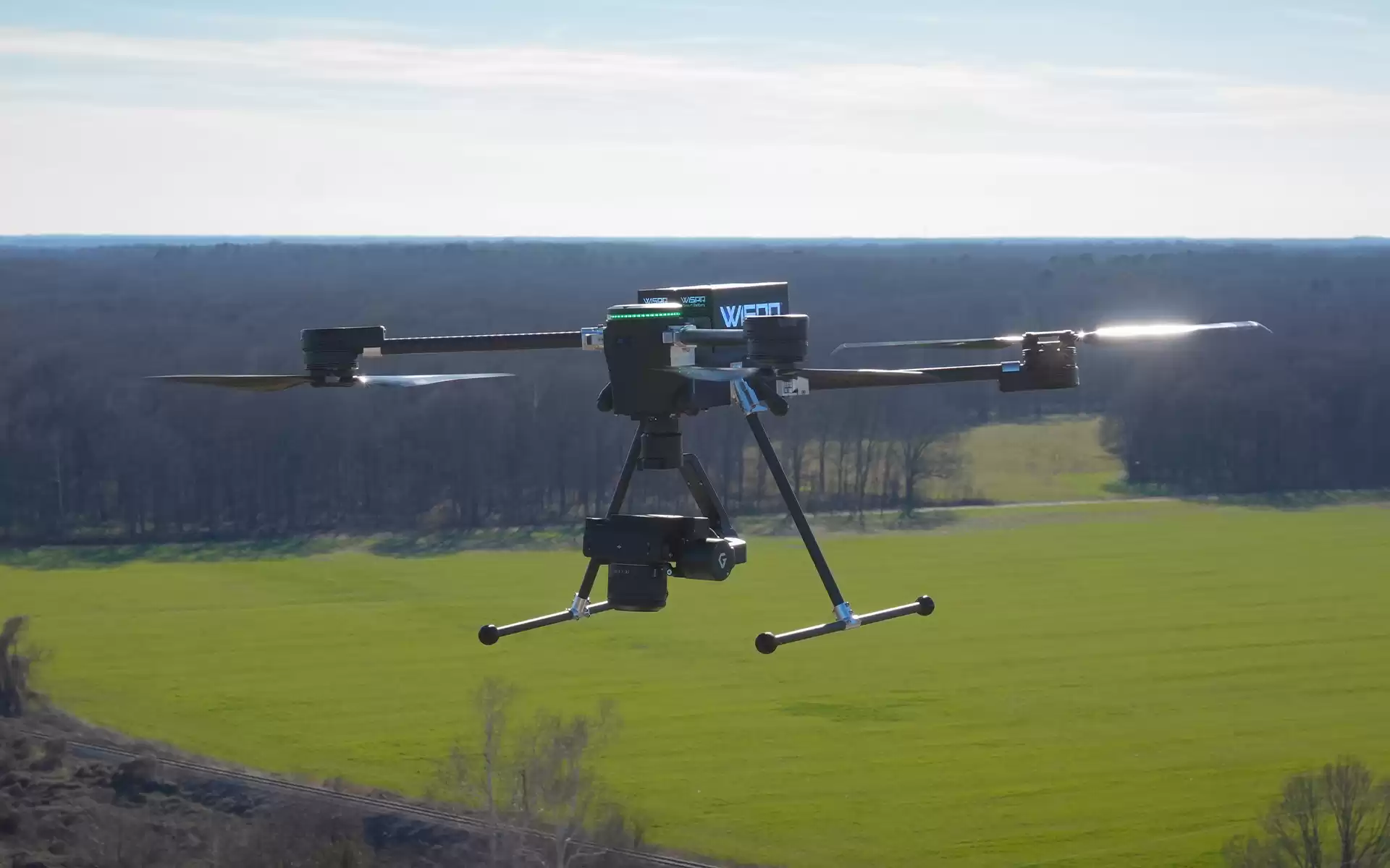
Advanced payloads deserve an airframe designed around them. SkyScout 2+ was engineered from the mount outward. Stable in flight, precise in position, and consistent across environments, so the data that comes off your sensor is the data you can actually use.
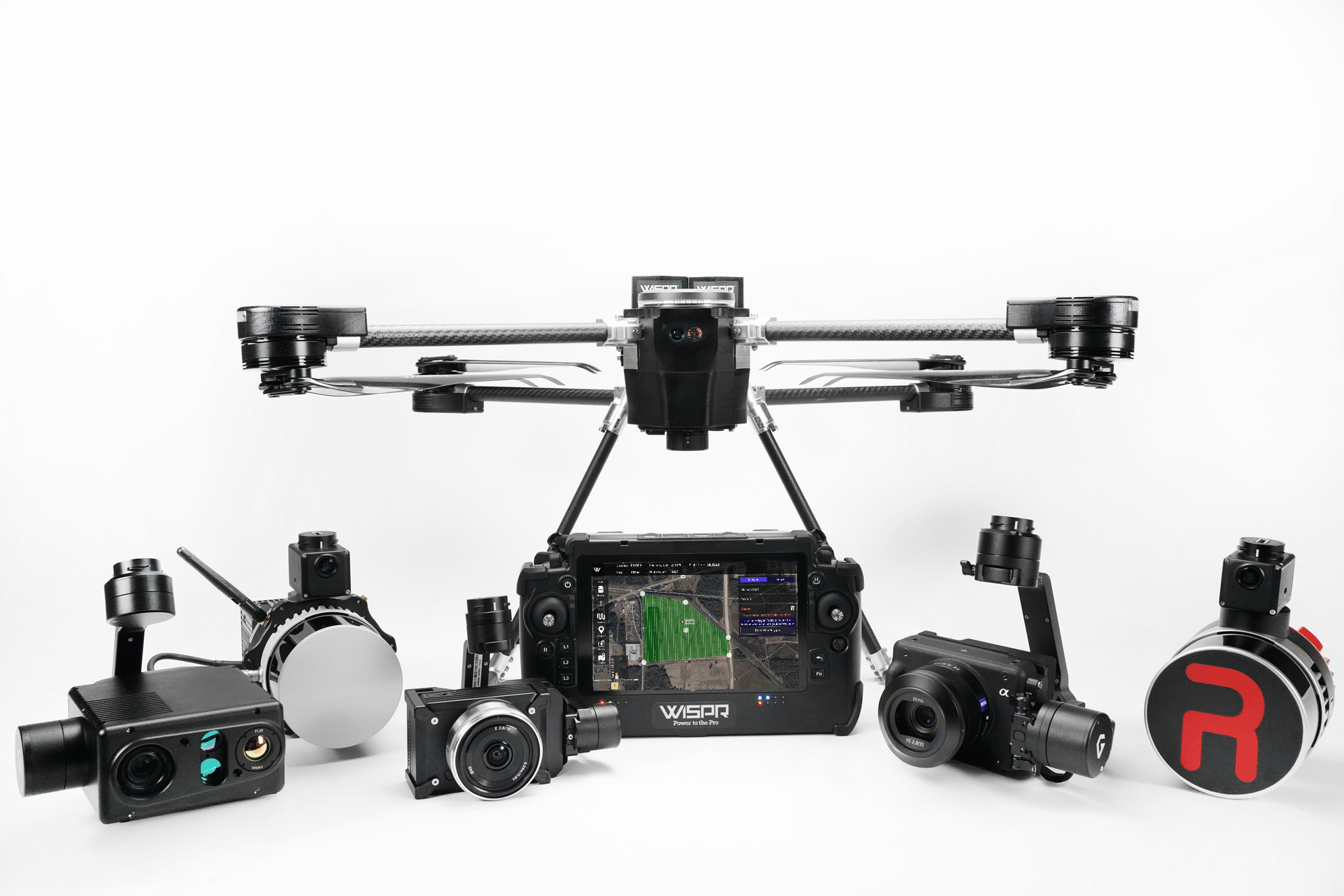
SkyScout 2+ supports an approved payload ecosystem, from survey-grade LiDAR to 61MP full-frame imaging and specialty sensors. Mounting, power, and data pipelines are already sorted. You don't have to build a gimbal adapter to get to work.
LiDAR data is only as good as the trajectory behind it. SkyScout 2+ ships with RTK positioning and HerePro GNSS standard, and PPK is available as an upgrade for teams that need the tightest post-processed alignment. Cleaner trajectories. Less strip-to-strip adjustment. Less time in your office fixing what the drone could have captured correctly.
Turbulent flight ruins point clouds. TempGuard holds the airframe and power system in spec across temperature ranges. SignalShield protects avionics from EMI. PathGuard and TerrainSense keep the drone on the planned flight path over varied terrain. The quieter the aircraft, the cleaner the data.
SkyScout 2+ flies up to 30 minutes with payload on a single battery, and the SmartCore hot-swap system means you never have to cool a motor down to change power. On a long corridor, a complex facility, or a methane sweep, you finish the job while you're on site, not the next week after a return trip.

SkyScout 2+ is approved for Blue UAS and Green UAS use, so the data you're capturing is collected on a platform that can actually be flown on federal sites, utility programs, and regulated infrastructure.
See Compliance Details"Pairing Sony's LR1 camera with the WISPR SkyScout 2 Series creates a powerful tool for real-world fieldwork. Seamless integration with the SkyScout 2's lightweight design and flight systems ensures stable operation, remote triggering, and precise geospatial alignment for professional-grade mapping and analysis."
"It has got to be by far the active cooling system. We have so many customers that are out in that heat, and we know what that does to batteries. That's going to do nothing but improve efficiency and keep this up capturing more data."
Aerial LiDAR and point-cloud mapping
3D modeling of towers, stacks, and vertical assets
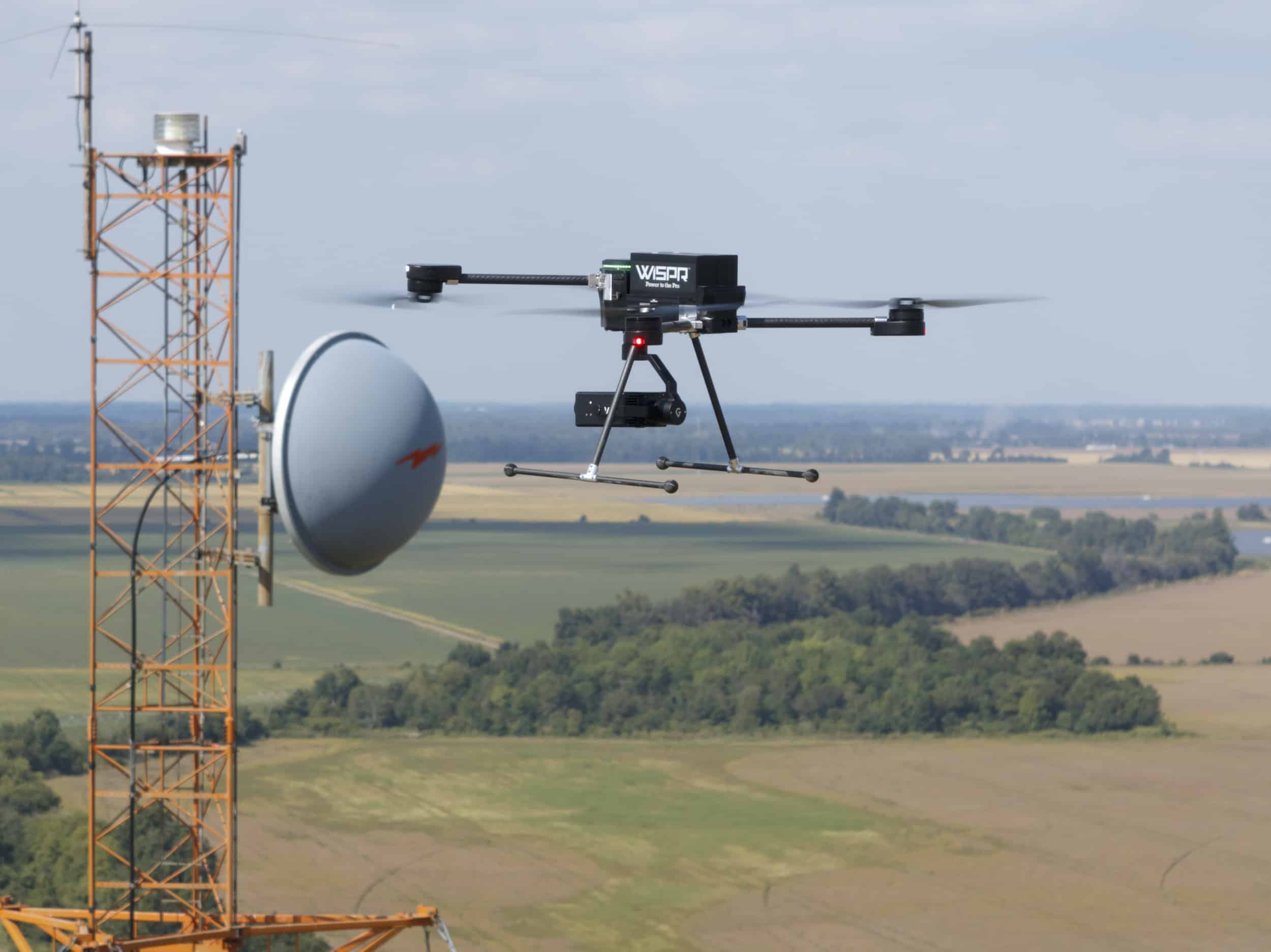
Corridor mapping: rail, road, transmission
Photogrammetry at 61MP full-frame
Methane and specialty gas detection
Combined LiDAR and photogrammetry missions
Tell us what you're capturing. We'll configure SkyScout 2+ with the right payload, positioning, and accessories, then send you a quote.
Call 662-479-4362Built in the U.S. Approved for regulated work. Ready to fly the day it lands.
Schedule a Demo